


All horse trails in the United States


Ready to explore the best equestrian trails near you? Equilab offers thousands of riding routes for scenic strolls, endurance training, and more. Discover verified trail maps to find the perfect path for your next adventure, and then track your ride – all using the world's best horse riding app.
Most popular trails


Forest roads; parking is tight and limited on the side of the road, must turn around to get out , small turn around options
Take road go down the switchbacks alongside the river and then come back up
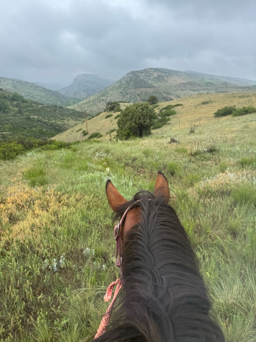
An easy loop with nice scenery
Titus up hill town hall back around
Mixed forest and prairie. Some obstacles available
Not a trail, the road.
Moderate, some obstacles
Paved rd, dirt road, and sand trail
One of the many loops that can be taken. The Creekside trail is one way due to it being a narrow trail with a few drop offs
Rocky but has good flat spots with canter areas. Some dogs and bikes

Kill deer loop and prairie circle loop
North Loop New; sometimes hard to follow; trail marked with both tree markers and some areas only with pink/green/orange tape.
Faster beginner to slower intermediate ride to cookout location

Moderate. Good footing. Lots of hills.
Lots of shade. No shortcuts back. Don't forget water. Spray yourself and your horses GOOD!
Day use to Joanna prairie loop to log cabin loop

Trails through the woods
Neighborhood trail, rock formations, water crossing

Jack’s loop in Big South Fork. Nice easy ride with plenty of options to gait.

Start at the very east end of baker lake and ride in 4.3 miles to noisy creek, take the camp trail and ride to the water for a picnic spot.
Spots were Kind of rocky, tiny water crossing then nice big creek at the end of trail, nice trail
Rolling wooded trails
Road , then up Lum road

New parking area- Changing terrain. Woods, fields, rocks, water crossing, road crossing. Ties in the shorter loop from older parking area, bypasses the old wooded rocky trail, goes up the hillside and back down across the road to the cannon fields. Does not cross the slick creek
Includes forest, thickets, meadow, and prairie riding. Natural surface trails with some shallow creek crossings
Sandy, rutty, shared trails with ORV


Hilly, dirt road first then into woods. Might have trees blocking, just go around. Gets grassy further in. Could go father then what we went.

Sand, grass, woods, meadow

One of many trails on this land. Super fun. Take plenty of water to drink. Requires a day/weekend pass. (free) online. Camping tent only.
Beautiful, mostly flat, with several creek crossings, some with steep banks. Occasional encounters with exotic animals, including llamas, b
Beth’s 5 mile
Hills, sandy and some rocky patches
Nice intermediate trail

North Ridge to Ridge Vista Point to Big Leaf Trail. Great in all weather conditions due to wide, well-maintained trails. Creekside and Canyon trails closed to equestrians during rainy season. No dogs allowed
Fenced gravel road with some road crossing

Gorgeous, shady trail. There are hills, rocks, and water to cross. Monday morning there were a few hikers. Sometimes I see mountain bikers.
One of the many possible loops out of the Olmstead Trailhead
Lots of hills - almost exclusively in the woods.

State park mixed use, equestrian trail only is north
Easy sandy trail. Along rge Suwannee.

Gravel road with 4+ access points to trails
A good trail to condition your horse

Rhonda, Earline, Ginger, Jeannie S. and friend, Tonia, Carol R., me

This is just one of the many trails Bridlewild has to offer. Water crossing, inclines, and a very scenic trail. Be advised that you might or will have to cross roads to continue to other parts of the trail. One part of the trail is extremely rocky, but that’s not on this part.
Neighborhood trail
Very pretty. Well groomed terriable horse trailer parking. Very small

Nice wooded and field trails.

Fall 24 Hunter pace
Single and double track
Powissett Farm and Noanet Woods
50 acre twice Jacktown once’s Tina’s side

A few hills, some areas that are muddy if its rained, pretty scenery, pretty easy going trail. There is a hunting area close by so orange is needed during hunting seasons.
Pond cordwood third trail

Easy to moderate trail. Mostly flat with a few hills. Some rocky areas but mostly barefoot friendly.

In and out, Rocky , small creek
Enter at trailer parking. There’s a sign “welcome riders” enter woods and follow signs. Eventually leads to beautiful manicured trails
some paved road, switch back on hill but went barefoot
Beautiful Old Florida mix of uplands and wetlands

Wide trail!! Beautiful views

Boulder Valley Ranch loopÔøº

First time riding out at Shimek Park!

All trails in the United States
Ready to explore the best equestrian trails in the United States? Equilab offers thousands of riding routes for scenic strolls, endurance training, and more. Discover verified trail maps to find the perfect path for your next adventure, and then track your ride – all using the world's best horse riding app.
FAQ about Equilab trails
You can explore these trails and many more within the Equilab app! Simply download the app onto your mobile device, create an account, and then head to the “Track” tab. There you can view thousands of trails to discover and ride.
No, Equilab empowers equestrians everywhere to discover and ride trails for free! By creating an account within the app (no payment needed), you will be able to see and ride all public trails. Our Premium subscription offers great additional features, which you can learn more about here.
You can control the visibility of any trails you create using Equilab by selecting different privacy options when saving the trails. If you choose to make a trail "Public", it will be visible here on our website and to anyone using the app. Private trails, on the other hand, are only visible to you and (if you're a Premium user) anyone you share them with. Note: If you rode on private property, we strongly recommend saving your trail as "Private".
Equilab’s list of trails currently only includes those that have been tracked by riders using the Equilab app. As a result, there are still many trails not yet included in our platform. Anyone can track trails and add them for free, however — giving you the chance to help others discover new places to ride!
Yes! You can add a trail from any ride you track using the Equilab app. To so, simply download the app, create an account, then record your ride on the trial.
Note that to create a trail, the ride must be at least 0.6 miles long, have taken at least 5 minutes, and must not have been tracked within an arena.
Our community members have added more than 35,000 public trails, and new ones are added every day. We hope you enjoy exploring them!

Contact our team
Feedback & Help
support@equilabapp.com
Press and Partnerships
marketing@equilabapp.com
Business Inquiries
admin@equilabapp.com


